Serua, Ciputat, South Tangerang City
Serua is a kelurahan (urban community) located within the Ciputat district of South Tangerang City, Banten, Indonesia. It plays a role as an administrative area and is part of the larger South Tangerang City, which is recognized as a rapidly growing satellite city of Jakarta. The South Tangerang City Hall is situated in this kelurahan.
Key Highlights
- Serua is one of seven kelurahans within the Ciputat district.
- As of mid-2022, the estimated population of Serua was 40,935.
- The area of Serua is approximately 3.68 km².
- South Tangerang City, where Serua is located, had an estimated population of 1,429,629 as of mid-2024.
- South Tangerang City's total area is 164.86 km².
- Property search trends in South Tangerang grew by 3.51% in the first semester of 2022, driven by hybrid work trends and more affordable housing prices compared to Jakarta.
- Land use changes in South Tangerang City from 2010-2020 show a significant reduction in mixed plantation areas and an expansion of residential areas due to private developer projects.
Location & Connectivity
Serua is located in the Ciputat district of South Tangerang City. South Tangerang is approximately 30 km southwest of Jakarta and is part of the Greater Jakarta metropolitan area. The city is primarily served by land transportation, including buses, minibuses (angkots), and taxis. Several major roads and highways facilitate access, such as the Jakarta-Serpong Toll Road, which connects to South Jakarta. The Jakarta-Tangerang Toll Road is located north of South Tangerang. Public transportation also includes the KRL Commuterline, with stations in South Tangerang on the Tanah Abang-Rangkasbitung Line, although specific stations within Serua are not noted. Future plans for the MRT Jakarta include a Lebak Bulus-Pamulang line with proposed stations in Ciputat.
Relevance
Serua, as a kelurahan in Ciputat, contributes to the ongoing urban expansion and development of South Tangerang City. The city's growth is characterized by the development of planned towns by private developers, attracting population growth and shaping business and commercial districts. This subdistrict is part of a region experiencing significant conversion of vegetated and open land into built-up and residential areas. The presence of the South Tangerang City Hall in Serua further underscores its administrative importance within the city.
Nearby
Nearby notable areas and facilities include the broader Ciputat district, which contains other kelurahans such as Serua Indah, Sawah, and Jombang. Shopping malls in South Tangerang include Bintaro Jaya Xchange Mall, Summarecon Mal Serpong, AEON Mall BSD City, and Living World Alam Sutera. Major roads like Jl. Ir. H. Juanda and Jl. Dewi Sartika are located in Ciputat. RSIA Hermina Ciputat, a hospital, is also situated in Ciputat. Additionally, BSD City, a large planned community, is a prominent area within South Tangerang.
Data Table
| Category | Data Point | Value |
|---|---|---|
| POI Type | Type | Kelurahan (Urban Community) |
| Region | Province | Banten |
| City | City | South Tangerang City |
| District | District | Ciputat |
| Serua Demographics (Mid-2022) | Estimated Population | 40,935 |
| Serua Geography (Mid-2022) | Area | 3.68 km² |
| South Tangerang City Demographics (Mid-2024) | Estimated Population | 1,429,629 |
| South Tangerang City Geography | Total Area | 164.86 km² |
Available units in Serua







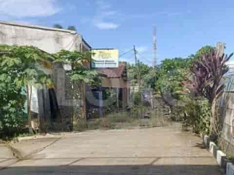
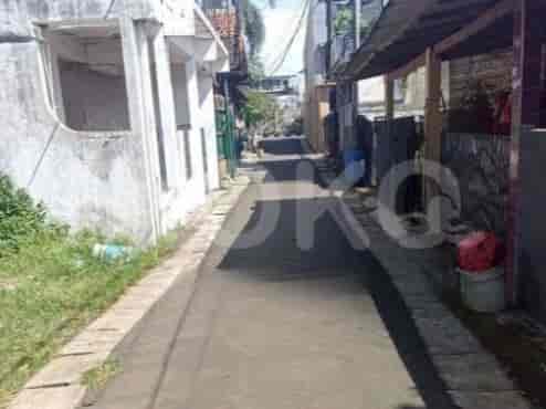
Nearby Facilities and Services - Serua
Graha CIMB NiagaBSD Green Office ParkThe Park Sawangan Office TowerCinere Bellevue Office TowerPalma TowerFIF Tower
Urban Heights ResidencesSerpong GreenviewAkasa Pure Living Embarcadero Bintaro ApartmentGreen Lake View ApartmentBaileys City Apartment
Modern Market BSDBintaro Jaya Xchange MallAEON BSDPondok Indah Mall 2Pondok Indah Mall 3Living World Alam Sutera
Lebak Bulus MRT StationFatmawati MRT StationCipete Raya MRT StationHaji Nawi MRT StationBlok A MRT StationBlok M MRT Station
Serua 01 Public Elementary SchoolState Islamic Senior High School South TangerangSekolah Insan Cendekia MadaniState Senior High School 9 JakartaSMK Negeri 1 Tangerang SelatanMadrasah Ibtidaiyah Negeri 1 Tangerang Selatan
Pembangunan Jaya UniversityUniversitas PamulangUIN Syarif Hidayatullah JakartaUniversitas TerbukaMonash University IndonesiaUniversitas Muhammadiyah Jakarta (UMJ) - Faculty of Medicine and Health Sciences
Rawa Buntu StationJurangmangu StationKebayoran StationLenteng Agung StationTanjung Barat StationUniversitas Indonesia Station
Buah Hati Mother and Child Hospital CiputatBunda Dalima Mother and Child HospitalIchsan Medical Centre (IMC) Bintaro HospitalPermata Pamulang HospitalVitalaya HospitalBuah Hati Pamulang Hospital
Ministry of AgricultureEmbassy of the Republic of SurinameEmbassy of the Republic of Marshall IslandsMinistry of Public Works and HousingRoyal Embassy of CambodiaEmbassy of Papua New Guinea
Greenwich ParkCiputat ParkBSD City Central ParkBumi Pamulang Asri Green Open SpaceTaman Kota BSDTaman Hijau Bintaro Jaya
Gaplek Bus Stop TransJakarta StationBSD City Bus Stop TransJakarta StationAEON Mall Bus Stop TransJakarta StationIntermark BSD City Bus Stop TransJakarta StationIntermark BSD Bus Stop TransJakarta StationBITC Bus Stop TransJakarta Station
Serpong-Ciputat BypassCiputat Toll GateBSD City Toll GatePintu Tol JombangSerpong Toll GatePintasan Toll Gate
Serpong Green Park FutsalBSD City Sports CenterMini Stadium Pondok BendaGreen Emerald Futsal & BadmintonRawa Buntu Sports CenterSerpong Jaya Badminton Hall
BSD City Convention CenterBintaro Jaya Xchange Convention Center (Often hosts sporting events)Assembly Hall BSD CityQ-BiC Convention CenterPrasetya Mulya Convention CenterICE BSD City
Kemiri MarketPasar KemuningPahlawan Street MarketBSD City Central MarketSudimara MarketCiputat Market (Near Southern Border)
See Similar Subdistricts
Sitemap
Index of Apartments for Rent in ProvinceIndex of Apartments for Rent in CityIndex of Apartments for Rent in DistrictIndex of Apartments for Rent in LocalityIndex of Apartments for Rent in AreaIndex of Apartments for RentIndex of Apartments for Rent Near AttractionsIndex of Apartments for Rent by Type Filter
Index of Apartments for Sale in ProvinceIndex of Apartments for Sale in CityIndex of Apartments for Sale in DistrictIndex of Apartments for Sale in LocalityIndex of Apartments for Sale in AreaIndex of Apartments for SaleIndex of Apartments for Sale Near AttractionsIndex of Apartments for Sale by Type Filter
Index of Office BuildingIndex of ProvinceIndex of CityIndex of DistrictIndex of SubdistrictIndex of MallIndex of Mrt StationIndex of SchoolIndex of Train StationIndex of AirportIndex of Embassy And Government OfficeIndex of UniversityIndex of Residential BuildingIndex of HospitalIndex of ParkIndex of Bus StopIndex of Toll GateIndex of Sports Complex StadiumIndex of Convention Exhibition CenterIndex of Supermarket HypermarketIndex of Traditional MarketIndex of Fnb Cluster Lifestyle StreetIndex of Place Of WorshipIndex of Civic Landmark Cultural Icon