Petojo Utara: A Subdistrict in Central Jakarta
Petojo Utara is a subdistrict situated within the Gambir district of Central Jakarta, part of the expansive Jabodetabek metropolitan area in Indonesia. Historically, Petojo was a shaded area with many trees, which were eventually cleared for urban development.
Key Highlights
- Located in the Gambir district of Central Jakarta.
- As of the 2010 Census, Petojo Utara had a population of 15,615.
- The subdistrict covers an area of 1.127 km².
- It has a population density of 13,855 inhabitants/km² as of 2010.
- Petojo Utara is administratively categorized as a 'kelurahan'.
- The postal code for Petojo Utara is 10130.
- The area is crossed by the Krukut River and Cideng River.
- Petojo Utara is undergoing area revitalization efforts, including cleaning waterways and mural painting, to improve tidiness and functionality.
Location & Connectivity
Petojo Utara is strategically located with access to several main roads. To the north, it borders Jl. KH. Zainul Arifin, to the south Jl. Balik Papan Raya / Jl. Suryopranoto, to the west Jl. Cideng Timur, and to the east Jl. Gajah Mada. The area is expected to be part of the future Jakarta MRT East-West line, with a planned station in Petojo. Numerous hotels are situated in Petojo Utara, indicating good accessibility for visitors.
Relevance
Petojo Utara functions as a residential and commercial area within Central Jakarta. Recent urban planning initiatives focus on improving its appearance and functionality, including managing street vendors and implementing aesthetic enhancements like murals, particularly near schools and commercial areas. Its historical development reflects Jakarta's broader urbanization, transforming from a leafy area into a denser urban environment.
Nearby
Petojo Utara is bordered by several other notable areas. To its south lies Petojo Selatan. Neighboring districts include Taman Sari, Duri Pulo, Cideng, and Kebon Kelapa. The subdistrict is also in proximity to major roads like Jl. KH. Zainul Arifin, Jl. Balik Papan Raya, Jl. Suryopranoto, Jl. Cideng Timur, and Jl. Gajah Mada. Nearby commercial establishments and facilities include schools and various shops. Gambir, Sawah Besar, Mangga Besar, and Pasar Baru are also nearby destinations.
Data Table
| Category | Data |
|---|---|
| POI Type | Subdistrict (Kelurahan) |
| Region | Jabodetabek, Indonesia |
| City Administration | Central Jakarta |
| District (Kecamatan) | Gambir |
| Area (2010) | 1.127 km² |
| Population (2010 Census) | 15,615 |
| Population Density (2010) | 13,855/km² |
| Postal Code | 10130 |
Available units in Petojo Utara


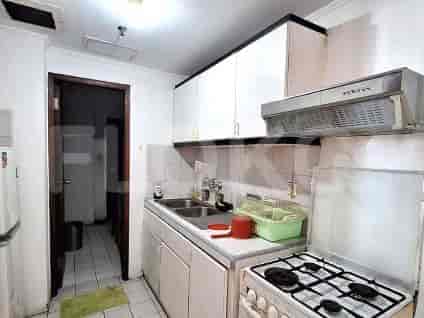


Nearby Facilities and Services - Petojo Utara
Gedung JayakartaITC Roxy Mas Office TowerGraha Lestari OfficeLindeteves Trade Center (LTC) GlodokWisma Antara Office TowerGlodok Plaza
Green Central City ApartmentPasar Baru Mansion ApartmentThe Boulevard ApartmentSeasons City ApartmentLucky Tower ResidenceThe Pakubuwono Menteng Apartment
Bundaran HI MRT StationDukuh Atas MRT StationSetiabudi Astra Station MRT StationBendungan Hilir MRT StationIstora Mandiri MRT StationSenayan Station MRT Station
Petojo Utara 11 Public Elementary SchoolPetojo Utara 09 Public Elementary SchoolPetojo Utara 01 Public Elementary SchoolPetojo Utara 07 Public Elementary SchoolPetojo Utara 05 Public Elementary SchoolPetojo Utara 03 Public Elementary School
Universitas TrisaktiTrisakti UniversityJakarta International CollegeUniversitas TarumanagaraUniversitas TarumanagaraTarumanegara University
Tarakan Regional General HospitalBudi Kemuliaan HospitalSumber Waras HospitalTambora Regional General HospitalKartini Mother & Child HospitalHusada Hospital
Ministry of State SecretariatMinistry of Internal Affairs of the Republic of IndonesiaMinistry of Defense of the Republic of IndonesiaMinistry of Women's Empowerment and Child ProtectionMinistry of Energy and Mineral Resources of the Republic of IndonesiaMinistry of Foreign Affairs of the Republic of Indonesia
Harmoni TransJakarta StationPetojo Hilir Bus Stop TransJakarta StationHarmoni Bus StopRSUD Tarakan Bus Stop TransJakarta StationGedung Arsip Nasional Bus Stop TransJakarta StationTanah Sereal Bus Stop TransJakarta Station
Gambir Toll GateTanah Sereal Toll GateKemayoran 1 Toll GateAngke Toll GateSlipi 1 Toll GateAngke Toll Gate
Mangga Besar Sports HallGrogol Sports HallSarinah Sports ArenaKemayoran Sports ComplexTaman Anggrek Sports ArenaJelambar Sports Center
Jakarta International ExpoJakarta International Expo KemayoranJIExpo KemayoranJIExpo Kemayoran (Jakarta International Expo)Jakarta International Expo (JIExpo) Hall D2 (often confused with sports complexes due to large event spaces)Kartini Exhibition Hall
Super IndoSuper IndoTransmartGrandLucky Pasar Minggu (While technically South Jakarta, its proximity/awareness often overlaps for listings near border areas like Cipinang/Pecenongan)Super IndoGrandLucky Sunter
Petojo Utara MarketPetojo MarketPetojo MarketKrukut Traditional MarketDuri Pulo MarketBatu Ceper Market
See Similar Subdistricts
Sitemap
Index of Apartments for Rent in ProvinceIndex of Apartments for Rent in CityIndex of Apartments for Rent in DistrictIndex of Apartments for Rent in LocalityIndex of Apartments for Rent in AreaIndex of Apartments for RentIndex of Apartments for Rent Near AttractionsIndex of Apartments for Rent by Type Filter
Index of Apartments for Sale in ProvinceIndex of Apartments for Sale in CityIndex of Apartments for Sale in DistrictIndex of Apartments for Sale in LocalityIndex of Apartments for Sale in AreaIndex of Apartments for SaleIndex of Apartments for Sale Near AttractionsIndex of Apartments for Sale by Type Filter
Index of Office BuildingIndex of ProvinceIndex of CityIndex of DistrictIndex of SubdistrictIndex of MallIndex of Mrt StationIndex of SchoolIndex of Train StationIndex of AirportIndex of Embassy And Government OfficeIndex of UniversityIndex of Residential BuildingIndex of HospitalIndex of ParkIndex of Bus StopIndex of Toll GateIndex of Sports Complex StadiumIndex of Convention Exhibition CenterIndex of Supermarket HypermarketIndex of Traditional MarketIndex of Fnb Cluster Lifestyle StreetIndex of Place Of WorshipIndex of Civic Landmark Cultural Icon