Cempaka Baru: A Subdistrict in Kemayoran, Central Jakarta
Cempaka Baru is a subdistrict located within the Kemayoran district of Central Jakarta, Indonesia. It was established in the 1980s as a division of the Harapan Mulya and Serdang kelurahans, necessitated by the dense population and considerable area of the original administrative units. The subdistrict is recognized for its structured residential areas, which developed with the creation of wide roads, leading to a well-arranged housing layout.
Key Highlights
- Cempaka Baru has a total area of 0.92 km² (92.00 hectares).
- As of the 2010 Census, the population of Cempaka Baru was 31,558.
- The population density in Cempaka Baru was 32,747 inhabitants per km² in 2010.
- The subdistrict is divided into 10 Rukun Warga (RW) and 138 Rukun Tetangga (RT).
- Cempaka Baru holds the postal code 10640.
Location & Connectivity
Cempaka Baru is situated in the Kemayoran district of Central Jakarta. The subdistrict is accessible via major roads, including Jalan Cempaka Baru II. Public transportation options are available, with bus stations such as Cempaka Baru, Pasar Cempaka Putih, and Rawa Selatan located nearby. The area is also in proximity to railway stations like Kemayoran Station and Pasar Senen Station, enhancing its connectivity within Jakarta. Jakarta's public transport systems are increasingly focusing on inclusivity and accessibility.
Relevance
Cempaka Baru serves primarily as a residential hub within Central Jakarta. Its development from larger, more densely populated kelurahans highlights urban planning efforts to manage growth and provide structured living environments. The subdistrict's local government office plays a role in facilitating administrative needs for residents, including permits for public works, education, health, housing, and spatial planning. Its integration into the broader Kemayoran area, which is transforming into a new central business district, suggests its evolving urban relevance.
Nearby
Cempaka Baru is located near the district of Kemayoran. Other nearby notable areas include Pasar Baru, approximately 3 km to the west, and Ancol, about 6 km to the northwest. The subdistrict is also in proximity to Pasar Senen market.
Data Table
| Category | Data |
|---|---|
| Area | 0.92 km² (92.00 hectares) |
| Population (2010) | 31,558 |
| Population Density (2010) | 32,747/km² |
| Number of Rukun Warga (RW) | 10 |
| Number of Rukun Tetangga (RT) | 138 |
| Postal Code | 10640 |
| District | Kemayoran |
| Administrative City | Central Jakarta |
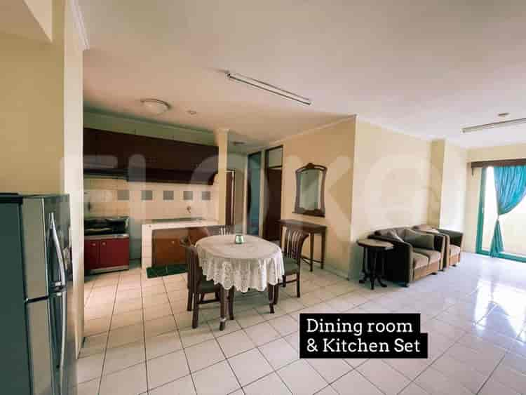
Available units in Cempaka Baru




Nearby Facilities and Services - Cempaka Baru
Kharisma BuildingGraha ReksoThe Premiere CorporationWisma Antara Office TowerGedung JayakartaMangga Dua Square Office Tower
Arandra ResidencePuri Kemayoran ApartmentMenara Jakarta ApartmentThe Mansion KemayoranGreen Pramuka City ApartmentSpringhill Terrace Residence
Bundaran HI MRT StationDukuh Atas MRT StationSetiabudi Astra Station MRT StationBendungan Hilir MRT StationIstora Mandiri MRT StationSenayan Station MRT Station
State Elementary School Cempaka Baru 11 MorningState Elementary School Cempaka Baru 15 MorningState Elementary School Cempaka Baru 12 MorningState Elementary School Cempaka Baru 14 MorningState Elementary School Cempaka Baru 09 MorningState Elementary School Cempaka Baru 13 Morning
Universitas YARSIJakarta State UniversityAkademi Keuangan dan Perbankan YPKP JakartaInstitut Kesenian JakartaJakarta Institute of ArtsSTIKES Cikini
Pasar Senen Train StationSentiong StationKemayoran StationKramat StationJuanda StationGambir Train Station
Yarsi HospitalSukapura Jakarta Islamic HospitalJakarta Islamic Hospital Pondok KopiKemayoran Regional General HospitalPertamina Jaya HospitalJohar Baru District General Hospital
Ministry of Finance of the Republic of IndonesiaMinistry of Foreign Affairs of the Republic of IndonesiaThe Apostolic Nunciature to IndonesiaMinistry of Trade Embassy of the United States of AmericaMinistry of Internal Affairs of the Republic of Indonesia
Jalan Cempaka Putih Barat ParketteCempaka Putih Public ParkRPTRA Sunter MuaraTaman Pulo MasJalan Prapatan Park AreaLapangan Banteng
Cempaka Putih Permai Bus Stop TransJakarta StationRawa Selatan Bus Stop TransJakarta StationPuskesmas Kemayoran Bus StopUtan Panjang Timur Bus Stop TransJakarta StationPerumahan Dwikora Bus StopGalur Bus Stop TransJakarta Station
Toll Gate Sunter (Often used by Kelapa Gading residents)Pulo Mas Toll GateCempaka Putih Toll GateToll Gate Wiyoto Wiyono (Near Kelapa Gading)Sunter Toll GateWiyoto Wiyono Toll Gate (Exit towards Tanjung Priok/Tanjung Perak)
Kemayoran Sports ComplexKemayoran Sports ComplexKemayoran Sports ComplexKemayoran Sports ComplexKemayoran Sports ComplexPluit Futsal Arena
JIExpo KemayoranJakarta International ExpoJakarta International Expo KemayoranJIExpo KemayoranJIExpo KemayoranJakarta International Expo (JIExpo) Hall D2 (often confused with sports complexes due to large event spaces)
Cempaka Baru MarketSumur Batu MarketUtan Panjang MarketPademangan MarketGalur MarketJohar Baru Market
See Similar Subdistricts
Sitemap
Index of Apartments for Rent in ProvinceIndex of Apartments for Rent in CityIndex of Apartments for Rent in DistrictIndex of Apartments for Rent in LocalityIndex of Apartments for Rent in AreaIndex of Apartments for RentIndex of Apartments for Rent Near AttractionsIndex of Apartments for Rent by Type Filter
Index of Apartments for Sale in ProvinceIndex of Apartments for Sale in CityIndex of Apartments for Sale in DistrictIndex of Apartments for Sale in LocalityIndex of Apartments for Sale in AreaIndex of Apartments for SaleIndex of Apartments for Sale Near AttractionsIndex of Apartments for Sale by Type Filter
Index of Office BuildingIndex of ProvinceIndex of CityIndex of DistrictIndex of SubdistrictIndex of MallIndex of Mrt StationIndex of SchoolIndex of Train StationIndex of AirportIndex of Embassy And Government OfficeIndex of UniversityIndex of Residential BuildingIndex of HospitalIndex of ParkIndex of Bus StopIndex of Toll GateIndex of Sports Complex StadiumIndex of Convention Exhibition CenterIndex of Supermarket HypermarketIndex of Traditional MarketIndex of Fnb Cluster Lifestyle StreetIndex of Place Of WorshipIndex of Civic Landmark Cultural Icon